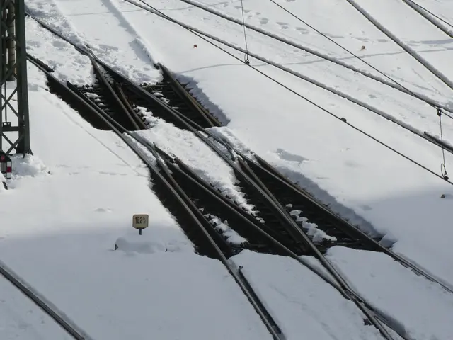
The smooth 'Gunda' is being driven away - Winter Storm Gunda Brings Chaos with Snow, Rain and Black Ice Across Germany
Milder Air Pushes Temperatures Up: Black Ice Risk Eases
The worst of the black ice is over as milder air moves in from the west. Germany's national meteorological service, the Deutscher Wetterdienst (DWD), expects icy conditions to improve.
On Monday, persistent frost will linger in the east and southeast. "In the southeast, freezing rain and black ice will likely remain a heightened risk until the early hours of Tuesday," said DWD meteorologist Sabine Krüger.
Icy Conditions Persist Only in the East
In the east and northeast, snow will continue falling until evening. Overnight—except in the immediate Oder-Neiße region—rain will turn to freezing rain. "Black ice is expected there starting Monday evening."
The icy conditions are caused by low-pressure system Gunda, which brought snow from the west, followed by rain that freezes on contact with subzero surfaces or air.
But even there, conditions will ease by Tuesday morning at the latest. "The rest of the week will bring mild, changeable weather with occasional rain," the DWD forecasts. "While patchy nighttime frost and localized icy spots cannot be ruled out, temperatures will generally remain mild."
Double-Digit Highs in the West
Temperatures will climb through the week, with some areas reaching double digits. On Tuesday, daytime highs will range from –1°C near the Oder Lagoon to 13°C in the Upper Rhine Valley.
Overnight into Wednesday, lows will drop to –3°C along the Alpine foothills, while the west stays above freezing, with temperatures up to 6°C. The DWD warns of lingering ice only near the Oder. By Wednesday, frost will have subsided: highs will span from 1°C at the Oder to 12°C in the Upper Rhine.

