Waymo and Waze team up to fix Los Angeles' pothole crisis with robotaxis
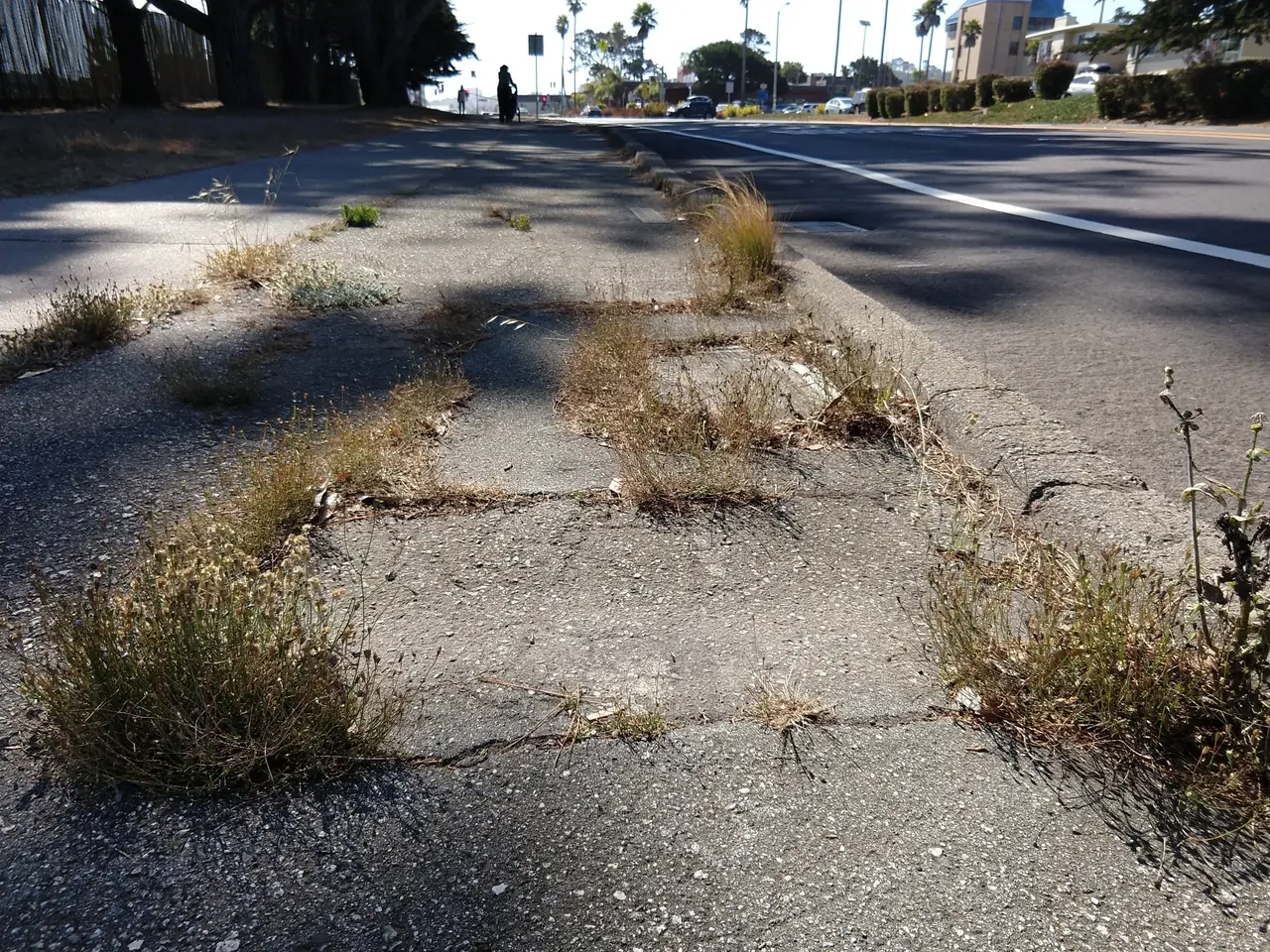
Potholes in roads seem to be a major problem in some countries right now, just ask those who drive in the United Kingdom.
But some areas of America are suffering too, and Los Angeles is one such location.
So in an effort to ease the problem, LA has roped in the navigation and robotaxi companies to help identify them across the city.
Why is Los Angeles using Waymo robotaxis for pothole repairs?
For clarification, the Waymo robotaxis themselves won't be repairing the potholes.
But Los Angeles is using them in a major way to help with the crisis.
Waymo and Waze teamed up on a pilot program for the city.
The self-driving vehicles will be used to identify potholes around LA.
Following this, the data they collect will be shared with city officials.
Ethan Teicher from Waymo spoke with our website about the pilot scheme.
"We've received feedback from officials around the country that this data would be a helpful, additional tool for addressing potholes on their roads," he told us.
The scheme actually goes hand-in-hand with what the robotaxi already does.
"We already collect this information to improve the behavior of our Waymo Driver, so that it better avoids potholes and drives over them smoothly when they are unavoidable," added Teicher.
How Waymo will work with Waze to improve road conditions
While Waymo will provide the vehicles, the robotaxi service is also working in conjunction with Waze to gather the data.
Any data collected will be shared directly with city officials who use the navigation platform.
"When we realized this data was high enough quality that it would be useful for cities, we worked with Waze to share it directly with officials who use their Waze for Cities platform," Teicher told our website.
"Today, Waze for Cities has over 2,000 users globally," he added.
In January 2026, residents reported more than 6,700 potholes across Los Angeles.
On top of that, 5,000 additional complaints were filed regarding them in February and March.
City officials have struggled to keep up with the repairs needed.
So this data provided to Los Angeles officials will be vital to finally fix the roads across the city.
Waymo timeline
- 2009: Google begins its self-driving car project in a secretive lab
- 2015: The team completes the world's first fully driverless ride on public roads in Austin
- 2016: The project officially spins off to become an independent Alphabet subsidiary
- 2018: The company launches its early commercial autonomous ride-hailing service in Phoenix
- 2020: The Phoenix service opens entirely to the general public without safety drivers
- 2021: Driverless operations expand to include select public testers in San Francisco
- 2024: The San Francisco robotaxi fleet drops its waitlist and opens to anyone
- 2026: The service reaches milestones of 200 million driverless miles and 500,000 weekly paid rides
Read also:
- United States tariffs pose a threat to India, necessitating the recruitment of adept negotiators or strategists, similar to those who had influenced Trump's decisions.
- Weekly happenings in the German Federal Parliament (Bundestag)
- Massive 8.8 earthquake hits off the coast of Russia's Kamchatka Peninsula, prompting Japan to issue a tsunami alert.
- Court petitions to reverse established decision on same-sex marriage legalization


