
Winter's Approach
Buckle up, folks, 'cause winter's coming with a wild, wet ride! Snow's on the horizon for the mountains, and the sun's making an occasional appearance to keep things interesting. It's looking like winter might finally get serious over the weekend.
The weather's been wild lately, with stormy, wet conditions taking turns with strong areas of high pressure. It's a sign that the weather in Europe is shifting towards winter, though it won't be a straightforward transition. Expect rain, snow, storms, and even some sunshine, riding the ups and downs of winter's unpredictable rollercoaster.
Things are calm and warm in the southwest of Europe, while the north is Winter Wonderland central. Central and southern Europe, however, are in for a turbulent ride. Cold air is heading towards Italy, where powerful lows with severe weather potential are forming. But details about the intensity and trajectories are still hazy.
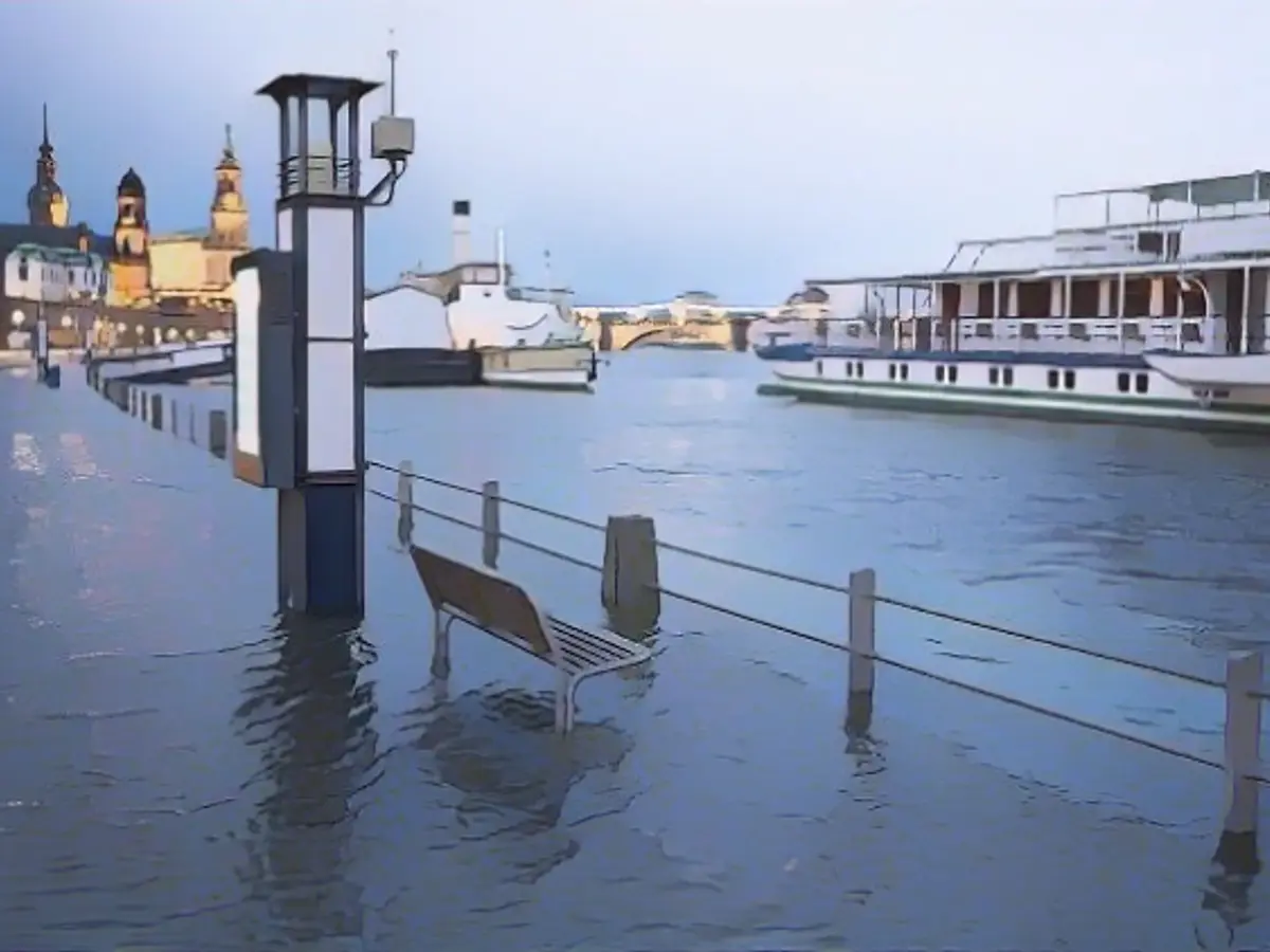
Rivers are full and the flood situation is tense in some parts of Europe. Despite the ongoing rain and massive thawing, extreme flooding isn't currently on the cards, thanks to occasional breaks in the rain and chilly temperatures. But a completely dry situation isn't in sight either, meaning water levels will remain high.
The major rivers like the Danube, Rhine, and Moselle are expected to peak on Monday or Tuesday. There's some relief in the middle of the week, but it's all very uncertain. How much rain will fall and at what temperatures? We'll have to keep a close eye on the situation.
Monday: The Week Begins with a Cloudy Start
Monday's kicking off changeable and wet, especially in the north. The south, on the other hand, will see more dry and sunny days in the Alps. Highs will range between 8 and 13 degrees with a lot of wind.
Tuesday: More Weather Changes on the Horizon
Tuesday's another changeable, wet day in many parts. Pay attention near streams and rivers, as the rain's causing problems. But there'll be clearing from the north, and the wind will shift to the northeast, bringing snowflakes to the Baltic Sea and the eastern mountains. Highs will be between 4 and 11 degrees.
Night to Wednesday: A Little Taste of Winter
Temperature's dropping, and it's getting wintry again in the mountains, with snowfall likely down to lower altitudes. The snow's also showing up in the Baltic Sea. Some areas will be quite slippery with frost, making it the coldest night of the season so far.
Wednesday: Time for a Bit of Sunshine
Sleet's flying in the eastern mountains, but there'll be more snow than rain. It could even be a white-out day in the Alps. From the northwest, new rain clouds will move in, but the sun will shine in between. Highs will be around -2 to +7 degrees, mostly hovering around +4 degrees.
Thursday: Stormy, Mild, and Miserable
Storms are brewing, bringing lots of clouds to Germany and lots of rain to most of Europe. It's rainy in the south, too, but there'll be good weather in the southwest. It'll be much warmer, with temperatures ranging from 3 to 13 degrees.
Friday: More Changes on the Way
Friday's looking changeable with rain all over, except for the southwest. Highs will be around 4 to 11 degrees. It might even snow in the mountains in the evening.
Weekend: Winter's Trying to Take the Spotlight
The weekend's shaping up to be exciting, with repeated showers sliding across Germany from northwest to southeast. The winter could finally make its grand entrance. But it's still too early to say where the line between wet and white will be.
The extreme weather conditions predicted for the weekend could make it an international event, with snow falling in various regions. Central and southern Europe, however, are at risk due to melting snow and ongoing rainfall, increasing flood risks.
Sources:
Enrichment Data:
- Snowfall Predictions: According to the GEFS model analysis, there are potential snowfall probabilities across different regions in Europe during the second ten days of February 2025.
- Winter Storm Eowyn: A winter storm named Eowyn is forecast to impact Ireland and the UK, bringing violent winds and heavy precipitation.
- Flooding Risks: Despite the predicted severe weather conditions, many EU countries are not adequately prepared for floods. The Commission's report highlights the need for proactive measures to mitigate potential flooding risks, including avoiding construction in flood-prone areas and improving early warning systems.
- Another large frontal system is expected to follow Winter Storm Eowyn, impacting most of Western Europe with even more unsettled conditions, severe winds, and rain squalls, potentially leading to flooding in areas like France, Spain, and Portugal.


