
Upcoming summer heatwave to strike the nation in August
A significant heat wave is expected to sweep across the United States in August 2025, according to meteorological predictions. This prolonged period of extreme heat will primarily be driven by a strong and persistent mid-level ridge of high pressure, often referred to as a "heat dome."
The heat dome is anticipated to cause daily maximum heat indices to exceed 38°C (100°F) in many areas, with some regions feeling as hot as 43°C (110°F) or higher. This heatwave is expected to bring one of the warmest periods of the summer, particularly impacting the central, eastern, southeastern, and southwestern U.S.
The heat wave will not only bring prolonged exposure to dangerous heat but also high humidity, creating hazardous conditions, especially for vulnerable populations. Some urban areas, like New York City and Tampa, have already set temperature records above 100°F early in the heat event.
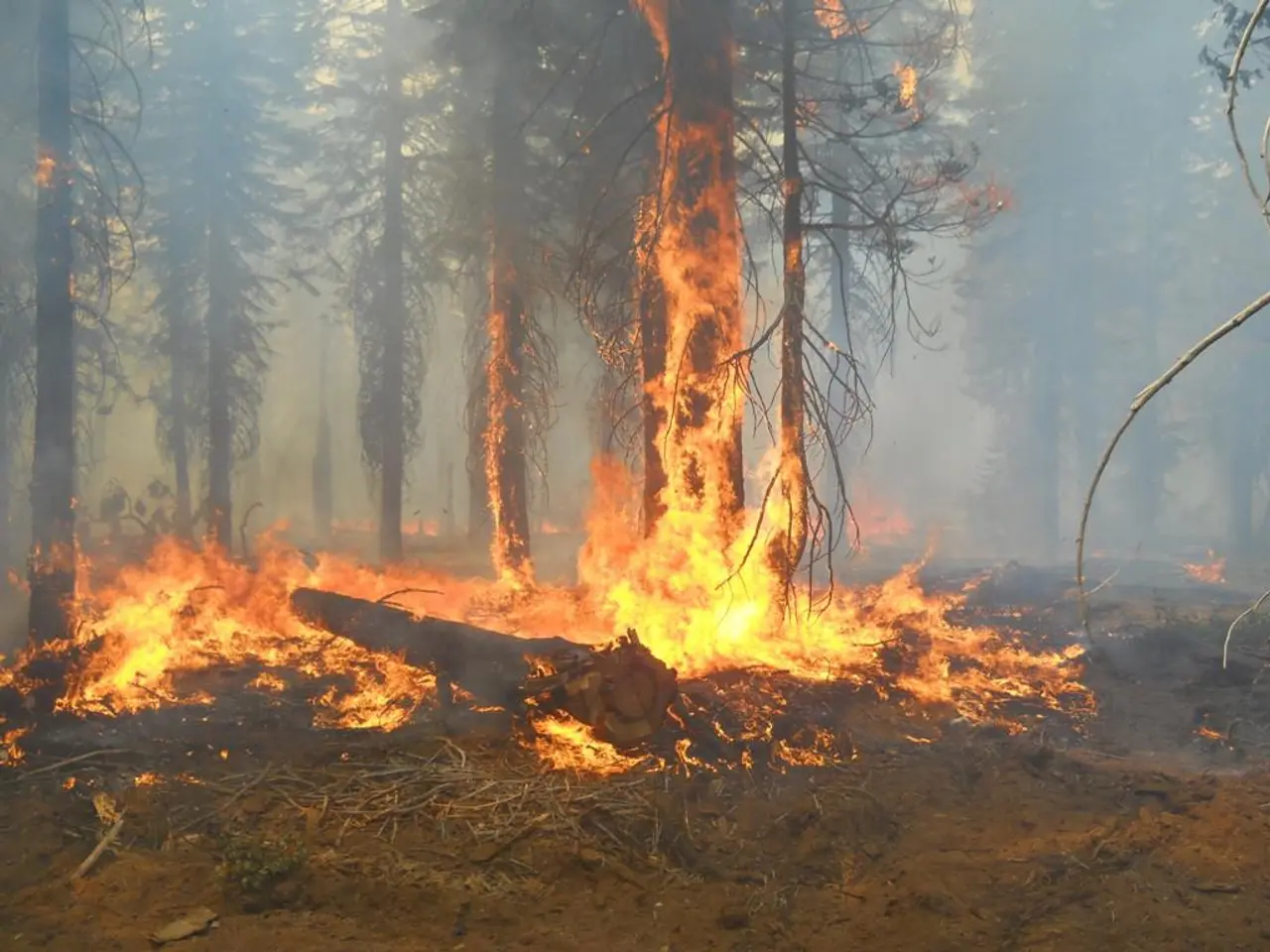
The main causes of this heatwave include an amplifying upper-level ridge building across the Southeast and central U.S., trapping hot air masses and preventing cooling. Additionally, dry conditions and drought are worsening across the Southwest, intensifying fire risk and amplifying heat stress. Reduced storm activity west of the Rockies and sustained heat are allowing wildfires to grow and spread, which also impacts regional air quality and heat stress.
Predictions indicate very high confidence (80-100%) for above-normal temperatures through August, extending from Colorado and the Dakotas across to the Great Lakes and into southeastern and southwestern states.
The heat wave will pose significant immediate health risks and environmental challenges due to the strong heat dome pattern, exacerbated by drought and wildfire conditions in the western U.S. The implications include increased risk of heat-related illnesses such as heat stroke and dehydration, elevated wildfire risk and ongoing large wildfires in the West, especially in drought-stricken areas like Utah and Arizona, strain on infrastructure such as power grids due to high air conditioning demand, potential impacts on agriculture, water resources, and outdoor labor productivity, and the need for public health advisories urging hydration, cooling, and care for vulnerable communities.
While most people are hoping for summer to finally return, the exact nature of the weather remains uncertain. However, the weekend in Baden-Württemberg will still be rainy, but the sky could soon clear, allowing for bright sunshine. The so-called Omega high is moving east, making room for the Azores high. The Azores high is expected to bring summer back to our country, replacing the high-pressure system that has been causing the cool and wet summer so far.
By next week, temperatures could exceed 30 degrees in some places, marking a significant change from the cool and wet summer that has been experienced so far. Several storms are predicted to push out the cold air and bring warmer air from the south. The return of summer, whether it's a heat wave in August or a warmer late summer, is a significant change from the cool and wet summer experienced so far.
- Despite the approaching heat wave, forecasts predict a change in weather for Baden-Württemberg next week, with temperatures exceeding 30 degrees and the Azores high replacing the current cool and wet weather-forecasting.
- In stark contrast to the imminent extreme heat sweeping across the United States, other regions might experience a relief from the heat as the Azores high brings warmer and drier conditions, providing a respite from the other weather issues they've been experiencing.


