
Understanding Hurricane Formation and Operation
In the Atlantic, hurricane season is a season of uncertainty, as hundreds of storm systems swirl out from the tropical regions surrounding the equator. Between 40 and 50 of these storms intensify to hurricane levels, bringing with them the potential for catastrophic damage.
One of the most memorable hurricanes in recent history is Hurricane Irma, among the strongest Atlantic hurricanes ever measured. Irma followed Hurricane Harvey less than two weeks later, causing widespread destruction in the Caribbean and parts of the United States. Hurricane Sandy, which made its way to the Eastern coast of the United States in October 2012, is another example of a hurricane's devastating power. Its path along the densely populated urban coast resulted in unprecedented damage and potential fatalities.
Hurricanes vary widely in physical size, with some storms being compact and others spreading out over hundreds or thousands of miles. As they move across the ocean, hurricanes build energy, sucking up warm, moist tropical air from the surface and dispensing cooler air aloft. This energy fuels the hurricane's powerful winds and torrential rain.
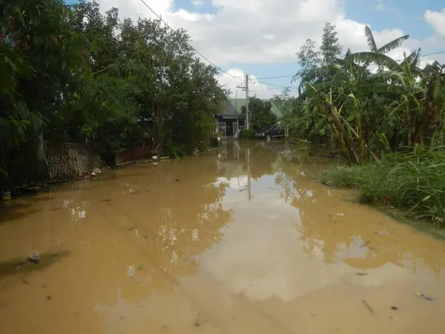
A hurricane's storm surge, a wall of water that precedes it, can cause significant inland flooding, especially when it coincides with high tide. Hurricanes also often spawn tornadoes, which are smaller, more intense cyclonic storms that cause additional damage.
The lifecycle of a hurricane involves three stages: tropical depression, tropical storm, and hurricane. Once a hurricane has formed and intensified, it will eventually encounter conditions that deny it the warm, moist air it requires, causing the storm to dissipate.
To monitor and track the development and movement of a hurricane, meteorologists rely on remote sensing by satellites, data gathered by specially equipped aircraft, and the work of the Hurricane Hunters. The Hurricane Hunters gather information about wind speeds, rainfall, and barometric pressures within the storm.
The Saffir-Simpson scale is used to classify hurricanes, with five categories ranging from Category 1 (74 to 95 mph) to Category 5 (157 mph or higher). The strongest hurricanes in Earth's history include Hurricane Patricia in the Eastern Pacific with sustained winds up to 215 mph (345 km/h), Hurricane Katrina causing massive destruction in the USA, and Hurricane Wilma with very low central pressure, indicating extreme intensity.
It's important to note that hurricane damage greatly depends on whether the left or right side of a hurricane strikes a given area. The right side of a hurricane packs more punch because the wind speed and the hurricane's speed of motion complement one another there. On the left side, the hurricane's speed of motion subtracts from the wind speed.
Meteorologists take all the storm data they receive and use it to create computer forecast models, called spaghetti models, to forecast a hurricane's path and changes in intensity well in advance of landfall. However, despite our best efforts, hurricanes can still catch us by surprise, as Hurricane Harvey did when it hit Texas in August 2017, causing flooding in one of the largest metro areas in the United States.
Hurricanes deliver massive downpours of rain, potentially dumping dozens of inches in just a day or two. They can churn the seas into a violent topography of 50-foot (15-meter) peaks and valleys, redefine coastlines, and reduce whole cities to watery ruin. The high sustained winds within a hurricane can cause widespread structural damage to both man-made and natural structures.
In the Southern Hemisphere, hurricane activity generally occurs from January to March, while the Northern Hemisphere's hurricane season runs from June 1 to Nov. 30. The Australian scale of cyclone intensity also classifies storms by wind speed and damage on a scale of 1 to 5, covering both hurricanes and tropical storms.
As we continue to face the challenges posed by hurricanes, it's essential that we remain vigilant and prepared. By understanding these powerful storms and their potential impact, we can take steps to protect ourselves and our communities.
Read also:
- Russia, according to Zelensky, lacks the prowess for launching another significant offensive.
- Russia's Latest Peace Proposals for Donbas: New Diplomatic Landscape Emerges amid Alaska Summit, Potentially Opening Ceasefire Opportunities
- Amidst India's escalating climate crisis, transgender individuals continue to persevere
- Contentious Discussion Surrounding the Movie Release of "Planet of the Humans"


