
Navigational woes in Bad Berka: Truckers led astray by inadequate route guidance
Experiencing more than a decade of issues, heavy-duty vehicles have been finding themselves in a pickle on the dangerously narrow roads of the Am Adelsberg residential area in Bad Berka. The most recent string of mishaps includes three occurrences in just the past four weeks!
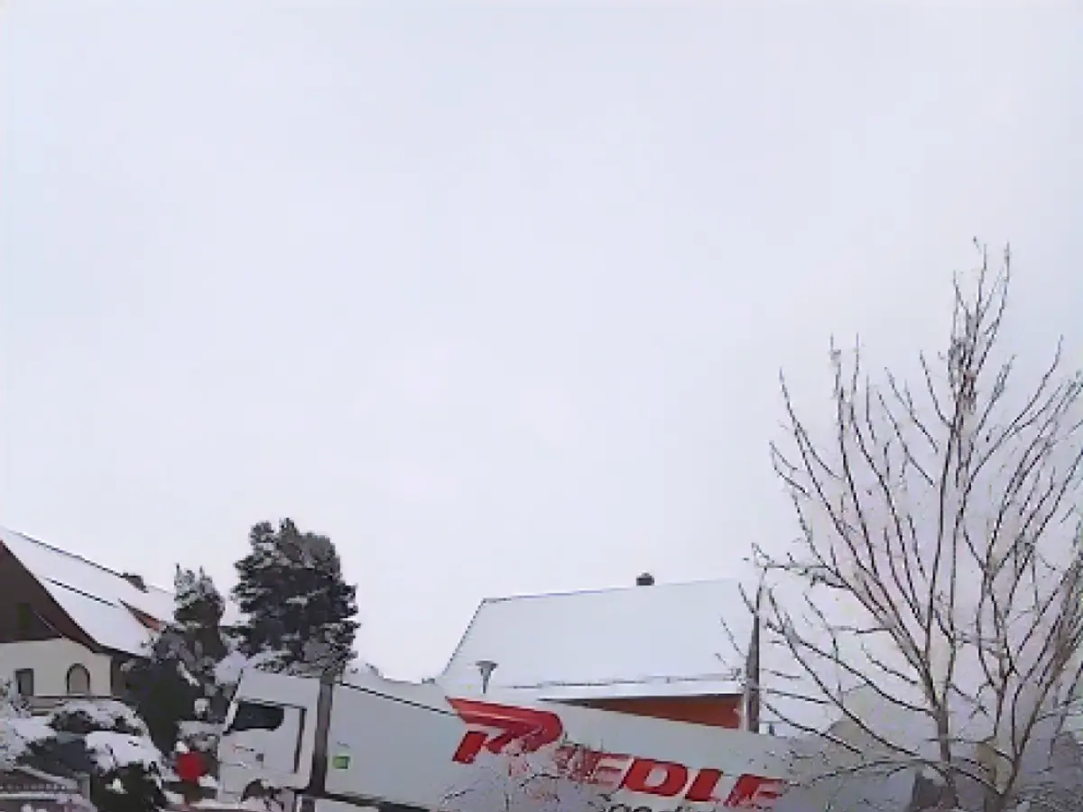
Resident Elmar Nolte (69) shares his dismay, “Since November 10th and 30th, as well as December 6th, these narrow roads became impassable due to massive trucks. These vehicles obstructed all possible entry points and required strenuous efforts to eventually free them. Clearly, the truck drivers are following their onboard navigation systems, leading them onto roads that haven't been roads for over a decade.”

Currently, the local neighborhood is reeling from this satnav-induced chaos and wants better, clearer solutions from navigation system manufacturers. According to Nolte, “Our environment has been dealing with this satnav insanity long enough. It is time to put pressure on the navigation device manufacturers, who can update their data sets at any time to ensure more precise routing for heavy vehicles. Why isn't this happening?”
On the most recent incidence, the truck driver in question had used three different navigation systems, and each of them misguided him and his 40-ton vehicle carrying 20 tons of Volvic mineral water to the wrong route.
Thuringia regional news is reporting on the worsening issue in Bad Berka, describing the ongoing trend of navigation systems misdirecting truck drivers onto roads that have ceased to be suitable for such heavy vehicles.
Additional Insights:
Navigation system manufacturers can prevent such mishaps by incorporating several critical features into their truck navigation apps:
- "Vehicle-Specific Route Planning": This feature accounts for a truck's dimensions (e.g., weight, height, width) to avoid going through low bridges or narrow tunnels.
- "Real-Time Traffic Information": Provide live traffic information and suggest alternative routes to avoid congested areas and potential hazards.
- "Customized Maps and Data": Integrate data about road types, ADR tunnel codes, environmental zones, and Hazmat restrictions for safer and more efficient transportation.
- "User Input and Feedback": Encourage users to report and rate any potential hazards to further improve the app's classifications.
- "Dynamic Lane Guidance": Assist drivers in navigating complicated traffic situations, reducing the likelihood of getting stuck on unsuitable roads.
- "Integration with Local Data": Utilize local knowledge and data to provide accurate and pertinent real-time road information, which can help avoid unsuitable roads.
By implementing these features, manufacturers can significantly decrease the percentage of heavy trucks encountering roadway challenges, thereby ensuring safer and more efficient transportation for drivers.
Sources: , ,


