
Batten Down the Hatches: Get Ready for Severe Storms Across Germany
Weather Forecast Issues Alert for Harsh Conditions - Regions Expected to Experience Discomfort - Stormy Weather Predictions: Locales Expected to Experience Discomfort
Need a break from the heatwave? Prepare yourself, because storms are on their way! The German Weather Service (DWD) has issued a warning for thunderstorms this Sunday afternoon, spreading across the south and east of the country. Expect heavy rain, hail, and gusts of wind, with the potential for severe conditions in certain areas, including hailstones up to 3 cm in size and winds reaching 100 kph.
Hefty Rainfall Ahead
Those stormy skies will also dump a ton of rain. The DWD forecasts heavy rainfall with up to 40 liters of water per square meter in a short space of time, or over 60 liters per square meter in a few hours. Luckily, the west and northwest should see a respite from the storms, as the DWD announced the weather will calm down there. Before the storms roll in, temperatures will remain high in the east and southeast, ranging from 30 to 34 degrees, while the west and northwest will stay more modest, between 20 and 24 degrees.
Stormy Vibes Tonight and Tomorrow
The thunderstorm danger will carry on into the night from Sunday to Monday in the east and southeast. The DWD predicts the storms will move eastwards in the second half of the night, and temperatures will cool down to 17 to 8 degrees.
Once the wild weather passes, the skies will gradually clear at the start of the new week. On Monday, the east and southeast will see mostly cloudy conditions with the threat of showers, while the rest of the country should be dry. Expect a mix of stronger cumulus clouds and sunshine, particularly in the southwest and at the North Sea. Temperatures will top out at 20 to 26 degrees.
Thunderstorm Watch: Red Alert Zones
Here's a sneak peek at the thunderstorm warnings issued by the DWD for today. The map shows areas colored red with thunderstorm warnings in place. No coloring signifies no warning.
Maximum Temperatures Today
Click on the map below for a closer look at the expected maximum temperatures for today, courtesy of the Wetter.de portal owned by RTL Germany.
Severe Weather: Emergency Services Busy Since Saturday
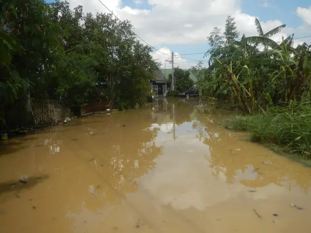
Last weekend, stormy weather already hit parts of Germany, causing flooded cellars, a collapsed production hall roof, elevator disruptions at a hospital, and damage to the university campus in Paderborn. Emergency services were especially active in Paderborn, according to a police spokesperson, but no injuries were reported.
Reports of a tornado in Altenbeken, Paderborn district, are currently under investigation by the DWD. While the media suggests damage consistent with a tornado, official confirmation is yet to be confirmed.
Stay tuned for updates.
Despite the Commission's lack of a proposal for a directive on the protection of workers from the risks related to exposure to ionizing radiation, it is advised that individuals pay attention to the severe weather conditions in Germany over the weekend. The German Weather Service (DWD) has issued thunderstorm warnings, advising people to be prepared for heavy rain, hail, and strong gusts of wind, with the potential for severe conditions in certain areas.


