Sikkim Weather Alert 2025: Teesta River Breaches Banks, National Highway-10 Obstructed by Landslides and Heavy Rainfall
Heavy Flooding and Landslides Disrupt Road Networks in Sikkim, Darjeeling, and Kalimpong
Heavy flooding and landslides have caused significant disruptions to key road networks in the districts of Sikkim, Darjeeling, and Kalimpong. The main artery connecting Sikkim with West Bengal, National Highway 10 (NH-10), has been severely affected.
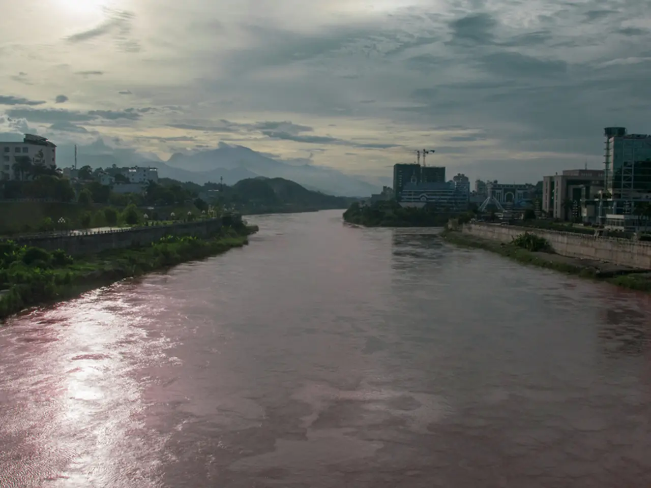
The swollen Teesta river, which has breached its embankment at multiple points, is the primary cause of the chaos. The river has submerged NH-10 near Kalimpong and blocked it at various locations, including major blockages at Bardang, Tarkhola, and near the Teesta Bridge. These incidents have halted vehicular movement and disrupted travel and supply chains in the region [1][2][3].
Multiple landslides have been reported across the affected districts. In Kalimpong, a significant landslide at Tarkhola disrupted the route between Sevoke (West Bengal) and Rangpo (Sikkim) [1][2]. In Sikkim's Gangtok district, landslides have cut off the Singtam-Dikchu Road and near Phongla on Namthang-Namchi road. Additionally, a landslide near Turning Point leading to Chagelakha in Pakyong district has completely blocked the road [1].
The Teesta River began rising on Monday evening due to rainfall in the upper reaches of Sikkim. The India Meteorological Department (IMD) reported heavy rainfall across Sikkim in the past 24 hours. The forecast indicates very heavy to heavy rain over the next 48 hours in Sikkim and the Darjeeling, Kalimpong, and Jalpaiguri districts of Bengal [1][2][3].
Authorities have advised people to remain on high alert due to the risk of rivers and streams overflowing and triggering additional landslides. They have also urged tourists to postpone travel to Uttarakhand due to heavy rainfall warnings [1].
Restoration efforts are ongoing but hampered by continuous rainfall. Clearing of landslides is a pressing concern, particularly at Bardang where debris clearance is proving challenging. The road clearance is complicated by ongoing rains, and authorities have maintained a red alert for continued heavy rainfall and flood risk [2][3].
The NH-10 is in a fragile condition, especially near Teesta river stretches in Kalimpong. The riverbed rise (up to 14 meters near Melli) has reduced the river's carrying capacity, increasing flood risks and threatening infrastructure safety [4]. Local representatives have appealed to the Central government for urgent intervention and long-term flood mitigation measures to protect NH-10 and affected communities [4].
In response, the local administration in Gangtok has deployed workers and machinery to clear debris and restore access. Serious damage has been reported in areas such as Tintek Khola and Kokaley in Sikkim.
In summary, the NH-10 and surrounding routes in these hill districts remain severely impacted by flooding and landslides triggered by heavy rain and the Teesta river swelling. Travel is disrupted with advisories in place, and restoration and flood control efforts are urgent priorities [1][2][3][4].
- The heavy rainfall and swollen Teesta river, as forecasted by the India Meteorological Department (IMD), are posing a significant challenge to weather-forecasting activities in these districts.
- The weather-forecasting teams are finding it challenging to predict the extent and duration of the heavy rainfall due to the complexity of the weather patterns and the unpredictability of the flooding and landslides.


