
Southwest region braces for excessive rain and thunderstorms, as Low Karlheinz sweeps in - Severe weather front led by Karlheinz brings hail and thunderous downpours in the southwestern region
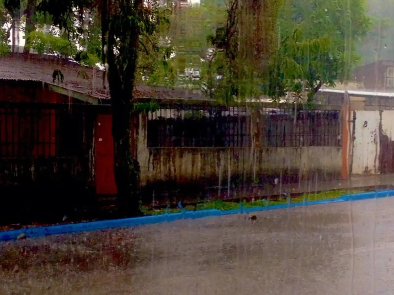
Overnight into Friday, Baden-Württemberg, Southwest Germany, is set to experience new showers and a few embedded thunderstorms. These showers are moving in from the northwest, originating from a stagnant weather system over southern Germany.
This weather system, causing continuous torrential rain, has been the source of concern for the German Weather Service (DWD). The DWD has warned of up to 150 liters of rain per square meter by early August, particularly affecting Baden-Württemberg and Bavaria. The risk includes strong to stormy gusts, hail, and potential local flooding, especially between the Black Forest and Bavarian Forest regions south of the Danube.
Isolated thunderstorms may continue intermittently, accompanied by cool and mostly cloudy conditions around the Black Forest area. The unsettled weather is linked to a stable disturbance over Germany amid high-pressure areas over the Mediterranean and Scandinavia, inducing a "summer monsoon" pattern.
Although northern areas north of a Saarland-to-Saxony line may see somewhat friendlier weather with sunny spells and only occasional showers or isolated thunderstorms, the southern regions face a more persistent wet and stormy pattern through at least early August.
Recent observations in Ulm and surrounding areas confirm a prevalence of showers, thunderstorms, and occasional heavy rain during July 2025, consistent with the broader regional trend of a wetter-than-usual summer month that also experienced above-average temperatures.
Looking ahead, the DWD expects many clouds, occasional showers, and isolated thunderstorms on Thursday in Baden-Württemberg. Temperatures will range from 19°C in the mountains to 25°C along the Upper Rhine. The west wind on Thursday will mostly be moderate, but can gust in some areas, making it windy on exposed Black Forest heights overnight.
The temperature range overnight will be between 17°C and 10°C. The DWD predicts that the low-pressure system, known as Karlheinz, will remain stubborn and prevent summery conditions until the start of the week. The DWD's forecast does not indicate a significant temperature rise for the start of the week.
Stuttgart, among other locations in Germany, will experience the unsettled weather overnight into Friday. The DWD's forecast applies to Germany as a whole, with the low-pressure system over the North Sea influencing the weather across the country. The DWD meteorologist mentioned that the weather across the country is being influenced by the low-pressure system over the North Sea.
- The Commission, in light of the ongoing concerns about the impending heavy rain in Baden-Württemberg and Bavaria, could potentially be consulted on the draft directive regarding the protection of workers involved in emergency services or weather-forecasting during these unfavorable weather conditions.
- As the Commission delves into the draft directive on the protection of workers from risks related to exposure to ionizing radiation, it might be prudent to also consider research on the potential effects of ongoing weather system-induced heavy rainfall and thunderstorms on radiation equipment and operations.


