
Rain persists, amplifying flood risks in Hesse
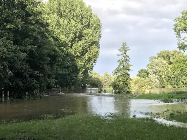
The relentless rainfall in Hesse, Germany, is adding fuel to the flood situation in Northern Hesse - particularly in the Eder, Diemel, and Fulda's upper reaches, as well as the Lahn catchment's western section and the Kinzig. The Hessian State Agency for Nature Conservation, Environment, and Geology (HLNUG) in Wiesbaden has reported level 1 surpassing at 29 sites and level 2 at six sites as of Saturday, with more severe flooding expected.
In fact, HLNUG warns that an exceedance of level 3 cannot be ruled out in northern Hesse. Two sites, Schmittlotheim/Eder and Dalwisksthal/Orke, have already exceeded level 2 and may see level 3 by Saturday evening. Other locations within the Lahn catchment area, Neckar, and Werra and Weser rivers are also dealing with similar rising water levels and flood warnings.
The cumulative effect of persistent rainfall on these water courses strains their capacity and increases the risk of villages becoming enclosed by flood waters, rendering roads impassable. Level 1 is the point at which flood waters reach the brim and flow over banks, while level 2 indicates a "major flood" affecting properties close to the banks and occasionally causing cellar flooding. Level 3 is a more critical situation where entire communities may be inundated.
As the floodwaters continue to rise, traffic and daily life will be disrupted in these affected areas. Authorities have urged residents to monitor local warnings and adhere to instructions as the situation evolves. For up-to-date information and additional resources, those impacted by the floods can consult the HLNUG website.
Though the specific causes of these severe flooding events are multifactorial, persistent or heavy-tailed rainfall distributions, catchment's runoff generation, and topographical factors can all contribute to the amplification of flood risks. Climate change projections suggest that intense rain events are becoming more widespread, exacerbating these risks even further. For a thorough understanding of the local flood dynamics and tailored risk assessment, detailed hydro-meteorological data and site-specific investigations are essential.
Sources:
Enrichment Insights:
- Spatial variability of rainfall, runoff generation, and topographic factors can contribute to heavy-tailed flood peak distributions and amplify flood risks.
- Climate change projections indicate that intense rain events are becoming more frequent, leading to increased flood risks.
- For a precise assessment of flood risks, site-specific data and investigations are crucial.


