Expansive Grand Canyon blaze intensifies into a megafire, generating its own atmospheric conditions; further developments anticipated.
Firestorm Clouds Over Grand Canyon's Megafire
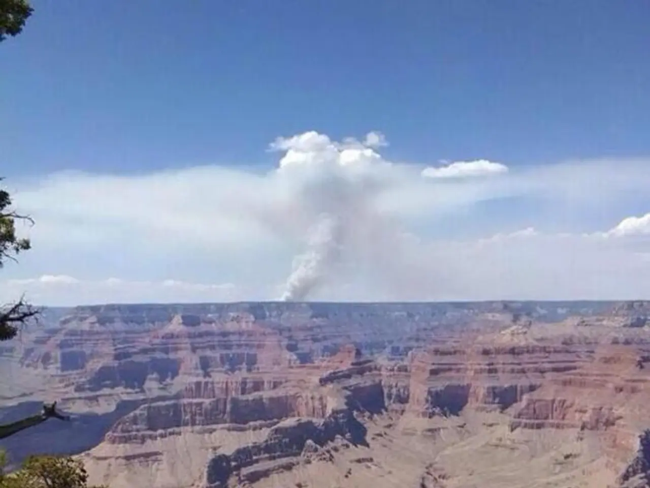
A megafire burning along the North Rim of the Grand Canyon, known as the Dragon Bravo Fire, has been generating towering pyrocumulus clouds for the past seven days. These intense convection clouds, also known as "fire clouds," are a result of the fire's intense heat and buoyancy, creating strong updrafts of hot air and smoke.
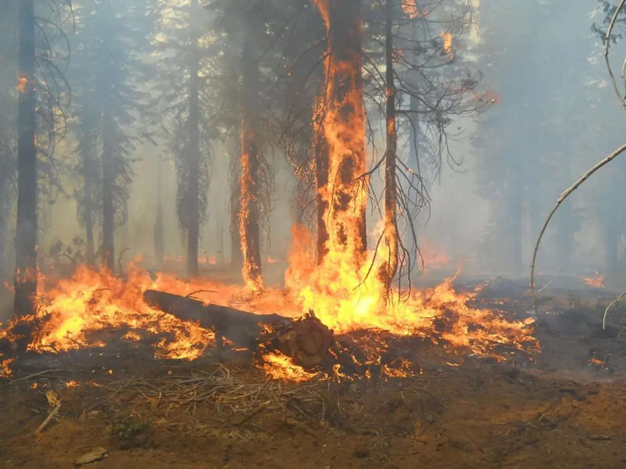
The Dragon Bravo Fire, which initially started as a controlled burn due to a lightning strike on Independence Day, has more than doubled in size since Sunday, covering an area about three times the size of Washington, D.C. As of Friday morning, the fire was 9% contained, and it has destroyed at least 70 structures, including the historic Grand Canyon Lodge and a visitor's center.
Pyrocumulus clouds can create their own weather systems, often dry thunderstorms with rapid winds underneath, which may spread fire quickly and unpredictably. If a pyrocumulus cloud collapses, it can produce downdrafts and firestorms, dramatically worsening fire conditions and threatening firefighters on the ground.
The development of these clouds depends on environmental factors such as atmospheric stability and humidity, which interact with the fire’s heat to promote cloud growth. In extreme cases, pyrocumulus clouds can escalate into pyrocumulonimbus clouds, leading to phenomena such as fire tornadoes with very high wind speeds.
Currently, the Dragon Bravo Fire is the largest fire burning in the lower 48 states. With frequent wind gusts of around 20 to 25 mph expected this weekend, and wind gusts up to 30 mph expected to pick up early next week, the fire's behavior remains unpredictable.
An extreme heat warning is in effect for the Grand Canyon through Tuesday, adding to the challenges faced by firefighters battling the blaze. Additional lightning strikes from these clouds could potentially start new blazes or reignite areas that have already been smothered, further complicating the situation.
The Dragon Bravo Fire reached megafire status after crossing the 100,000-acre threshold, underscoring the scale and intensity of the fire. The containment level has been significantly lowered due to worsening weather conditions this week.
These pyrocumulus clouds serve as a stark reminder of the power and unpredictability of wildfires, and the challenges faced by firefighters in controlling them. As the battle against the Dragon Bravo Fire continues, the focus remains on ensuring the safety of those in the area and minimizing the damage to the environment and infrastructure.
- The scientific understanding of weather-forecasting is crucial in predicting the formation of pyrocumulus clouds, which can create their own weather systems and pose significant threats to the environment and infrastructure during a megafire like the Dragon Bravo Fire.
- Climate change and environmental science play a role in understanding the factors that contribute to the intensity and unpredictability of megafires, such as the Dragon Bravo Fire, which have been observed to generate pyrocumulus clouds.
- In the midst of battling a megafire, the weather forecast becomes even more crucial, as it can help predict the development of pyrocumulus clouds and the associated risks of dry thunderstorms, firestorms, and fire tornadoes, which can further complicate efforts to contain the fire.


