Torching Troubles in Bavaria: A Forest Fire Crisis Unleashed
Elevated forest fire danger forecasted in Bavaria - Burning forest incidents in Bavaria pose a significant threat
Bavaria's lush greenery is now a tinderbox, with a colossal risk of forest fires looming large. The German Weather Service (DWD) has issued the highest alert (Level 5) for several regions within this Free State, including Rothenburg ob der Tauber, Schwandorf, Weidenbach-Weiherschneidbach, Regensburg, Garmisch-Partenkirchen, and Wielenbach. Many other regions are classified as high-risk (Level 4), and this danger is expected to persist over the coming days.
These flames, fueled by the scorching heat and dry conditions, have caught the attention of the authorities. Consequently, aerial observation flights are being scheduled for Middle Franconia and the Upper Palatinate on Wednesday, and Lower Bavaria on Thursday. The primary objective is early detection and minimizing spreading of any potential blazes. Last week, such aircraft were already in action across various regions of Bavaria, with the Bavarian Air Rescue Squadron's planes manned by firefighters, foresters, and pilots.
Authorities are sounding the alarm, urging "extreme caution" when venturing into forested areas. Open fires or smoking in forested regions, either closer or farther from trees, is strictly prohibited for forest owners, hunters, and workers alike in certain jurisdictions such as Lower Bavaria. The city of Lohr am Main has effectively banned all open fires within its limits, while Aschaffenburg has prohibited open fires on fields, meadows, or undeveloped land, effective as of Wednesday and lasting until July 24.
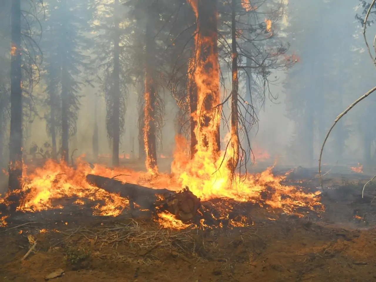
A forest south of Nuremberg was ablaze on Tuesday, engulfing an estimated area of 30,000 square meters at Wendelstein in the Roth district. Fire crews were able to contain the conflagration by the evening, naturally, while searching for embers to snuff out. However, crews remained vigilant to prevent any reemergence of hotspots, as the risk is low.
Over 700 personnel from several fire departments, the police, and the mountain rescue service were mobilized for the operation. To ensure public safety, a residential care facility was evacuated as a precaution, with residents urged to avoid the affected area due to the risk of falling trees. The cause behind this inferno remains unknown, but the criminal police have launched an investigation.
Considering the escalating threat from climate change, the current forest fire prevention programs and alerts in Bavaria incorporate advanced scientific analysis and preventive strategies. For instance, the Bavarian State Institute of Forestry relies on climate projections, indices like the Canadian Forest Fire Weather Index (CFFWI), and the “Bayern-Ensemble” climate models to anticipate and identify areas with high fire risk. Based on these assessments, high-risk zones receive targeted preventive infrastructure, water resource preparation, and detailed deployment mapping.
All in all, the dominating fire threat in Bavaria is combated by a blend of climate-driven risk evaluations, physical preventive infrastructure, water resource preparedness, and deployment planning, while local warnings and monitoring guide public and emergency responses in areas like Rothenburg ob der Tauber, Schwandorf, Regensburg, Garmisch-Partenkirchen, and Wielenbach.
Scientists at the Bavarian State Institute of Forestry are utilizing advanced environmental-science techniques, such as climate projections and indices like the Canadian Forest Fire Weather Index (CFFWI), to anticipate and identify high-risk areas for forest fires. The Commission has also adopted a proposal for a directive on the protection of workers from the risks related to exposure to ionizing radiation, given the potential use of radiological tools in monitoring and combating forest fires.


