Heed the Warning: Bavaria Faces High Forest Fire Risk
Elevated danger of forest blazes in the region of Bavaria - Bavarian wildfires pose significant danger.
In Bavaria, Germany, the risk of forest fires is skyrocketing. The German Weather Service (DWD) has cranked up the forest fire danger index to level 5 (very high risk) in several regions for this Wednesday. Areas around weather stations in Rothenburg ob der Tauber, Schwandorf, Weidenbach-Weiherschneidbach, Regensburg, Garmisch-Partenkirchen, and Wielenbach are especially vulnerable. Many other regions see a high-risk (level 4) forest fire situation.
Air observation flights are back in the air on Wednesday, focusing on Middle Franconia and the Upper Palatinate, with continuation planned in Lower Bavaria on Thursday. These missions aim to detect forest fires early to combat their spread as much as possible. Aircraft have been hard at work since the weekend in several regions of Bavaria due to heightened forest fire risk.
Government agencies like the Government of Lower Bavaria are urging the utmost caution in forested areas. Open fires are a definite no-no, and smoking is strictly prohibited in forests. The same goes for forest owners, hunters, and anyone working in forestry—no open fires, even from a safe distance of 100 meters from a forest.
The city of Lohr am Main has barred any open fire within the city limits due to the acute fire risk. The city will update when the ban is lifted. In Aschaffenburg, open fires on fields, meadows, or undeveloped land are prohibited from Wednesday onwards. The ban is initially in effect until July 24, outside the built-up area.
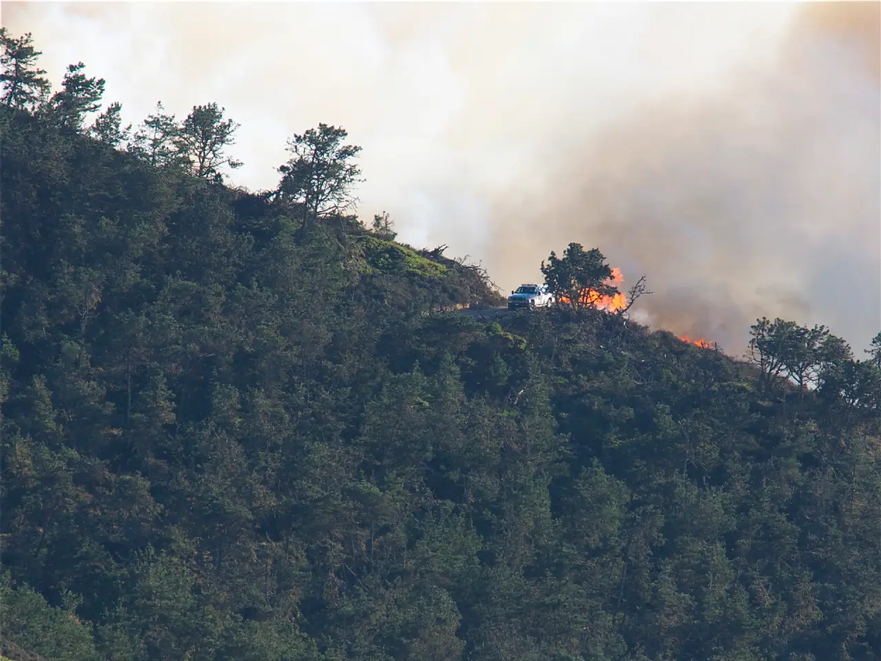
On Tuesday, a forest south of Nuremberg caught fire, affecting approximately 30,000 square meters in Wendelstein. The fire was extinguished by the evening, but firefighters were still searching for smoldering spots. The risk of these spots reigniting is considered low, but crews will remain vigilant to prevent any potential flare-ups. Over 700 firefighters from neighboring departments, along with police support via a helicopter and mountain rescue services in several vehicles, were involved in attempting to contain the blaze.
A assisted living facility was evacuated as a precaution on Tuesday for several hours due to the approaching fire. Residents are strongly advised to avoid the affected area, as numerous trees may fall. The cause of the fire remains unknown, and criminal police have launched an investigation.
Germany's relatively dry spring and temperatures potentially reaching 34 degrees Celsius on Wednesday contribute to the increased fire risk. Locally, there may be rain and thunderstorms.
Bavaria employs a multipronged approach to combat forest fires, encompassing climate-based risk forecasting, infrastructure and resource preparation (fire breaks, water supplies), advanced technological monitoring (drones, AI-based detection), and coordinated emergency response planning. The German Weather Service plays a crucial role, providing meteorological data that inform fire prevention strategies and issuing warnings about fire weather conditions. These efforts reflect an integration of scientific understanding, cutting-edge technology, and operational readiness to better manage forest fires under changing climate conditions.
- Bayern
- Forest Fire
- Forest Fire Danger
- Nuremberg
- Munich
- Forests
- DWD
- Rothenburg ob der Tauber
- Schwandorf
- Regensburg
- Rain
- Garmisch-Partenkirchen
- Wielenbach
- Middle Franconia
- Upper Palatinate
- Lower Bavaria
- Weekend
Behind the Scenes:
- The Bavarian State Institute of Forestry conducts scientific analyses using climate projections to predict future forest fire risks in Bavaria as part of the MultiRiskSuit project.
- Preventive measures like constructing and maintaining fire breaks, ensuring adequate water supplies, and preparing deployment maps support emergency response.
- The German Weather Service uses weather data to determine fire conditions, enabling timely warnings and situational awareness.
- Europe is moving toward unified wildfire strategies incorporating new technologies such as drone-based monitoring and risk simulation platforms to enhance real-time monitoring and rapid detection of fire outbreaks.
- Practical field testing of fire detection technologies is underway, such as the SmokeD Alerts Pro system used in international fire labs.
- Regional and cross-border emergency coordination projects implement community training, multifaceted approaches, and collaboration to manage wildfire risks more effectively.
- The Bavarian State Institute of Forestry, as part of the MultiRiskSuit project, uses scientific analyses based on climate projections to predict future forest fire risks in Bavaria.
- To support emergency response, preventive measures such as constructing and maintaining fire breaks, ensuring adequate water supplies, and preparing deployment maps are implemented.
- In addition to these efforts, the German Weather Service utilizes weather data to determine fire conditions, enabling timely warnings and situational awareness.
- As Europe moves towards unified wildfire strategies, new technologies such as drone-based monitoring and risk simulation platforms are being integrated to enhance real-time monitoring and rapid detection of fire outbreaks, reflecting an integration of scientific understanding, cutting-edge technology, and operational readiness to better manage forest fires under changing climate conditions.


